Get Started
Information and the tools to start you on your way to being car free.
Car-Free Near Me
See the transportation services available near your home, office, your current location, or any location in the Washington, D.C. area with Car-Free Near Me. This tool not only shows you the bus stops close to your location, it shows where the buses go that serve each stop. Also rail stations, Capital Bikeshare stations, Zipcar locations, and more.
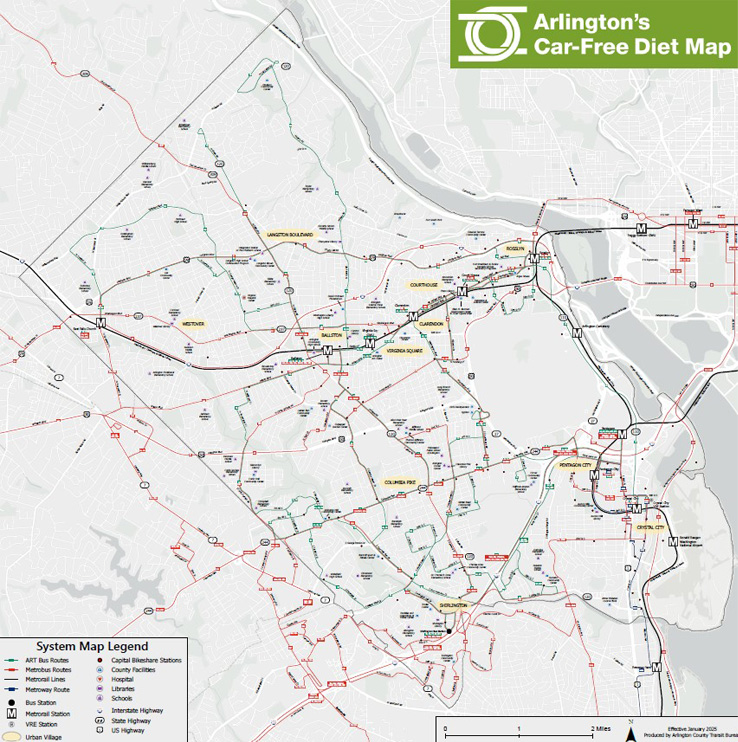
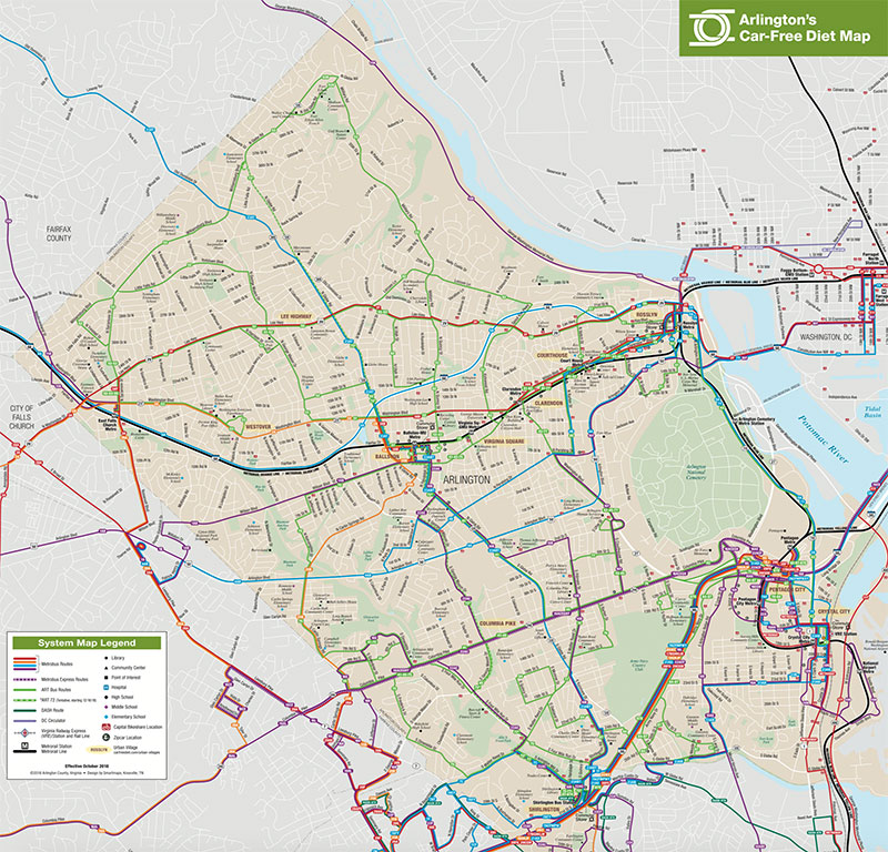
Arlington's Car-Free Diet Map (PDF)
Map of Arlington showing bus routes, bus stop locations at Metro stations, Metro stations, Capital Bikeshare stations, and more. Click the link or thumbnail image below.
Arlington's Car-Free Diet Map (PDF, 1.66 MB)